The horizon, the cardinal directions, the movement of the sun, and the ice ages in Earth's history. To illustrate the reality of human-caused climate change, the rapid transformation of the alpine environment, and the disappearance of our glaciers, the installation Our Glacial Perspectives by artist Olafur Eliasson draws attention to the broad interconnections of time and space and the development of our planet.
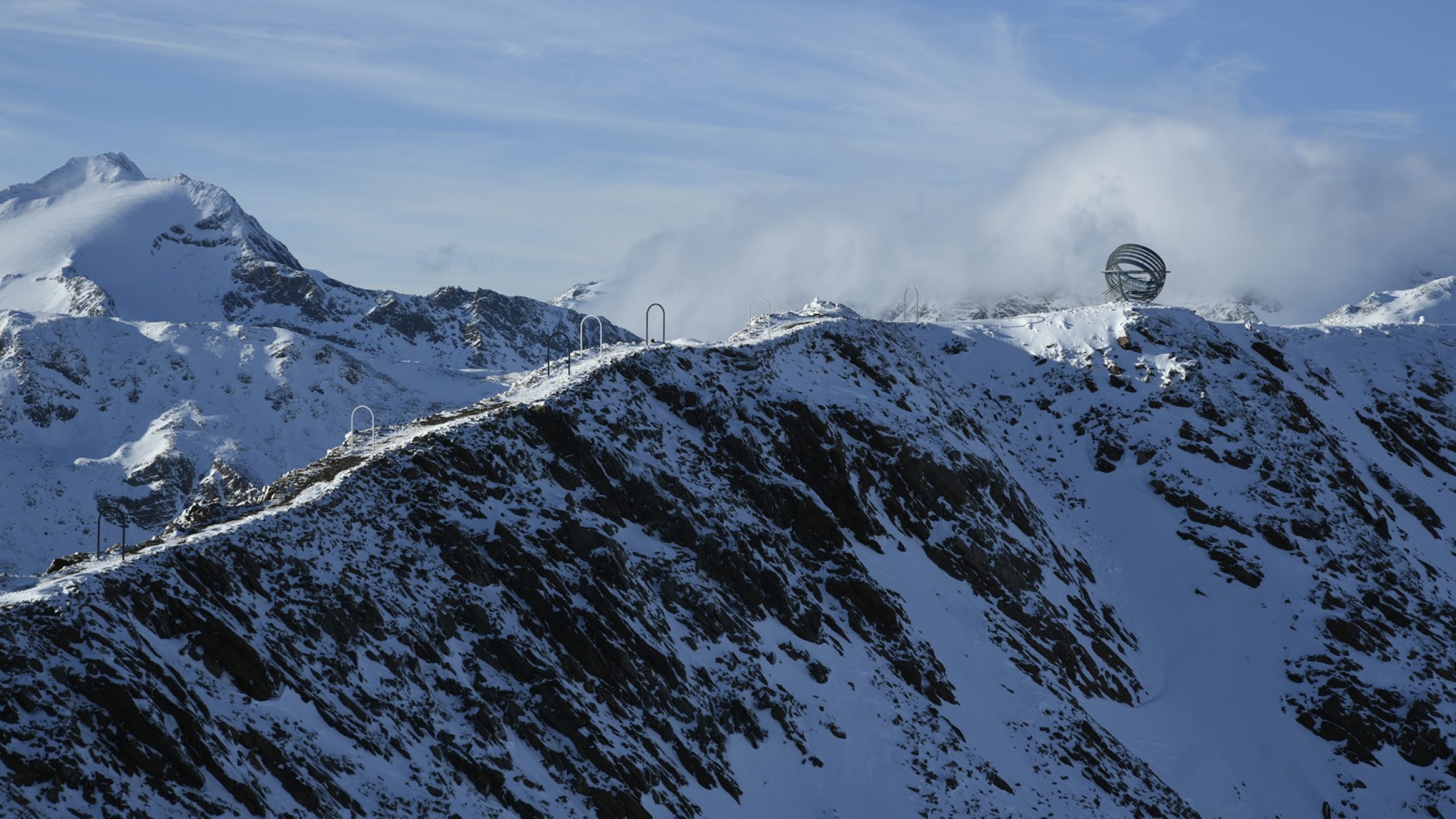
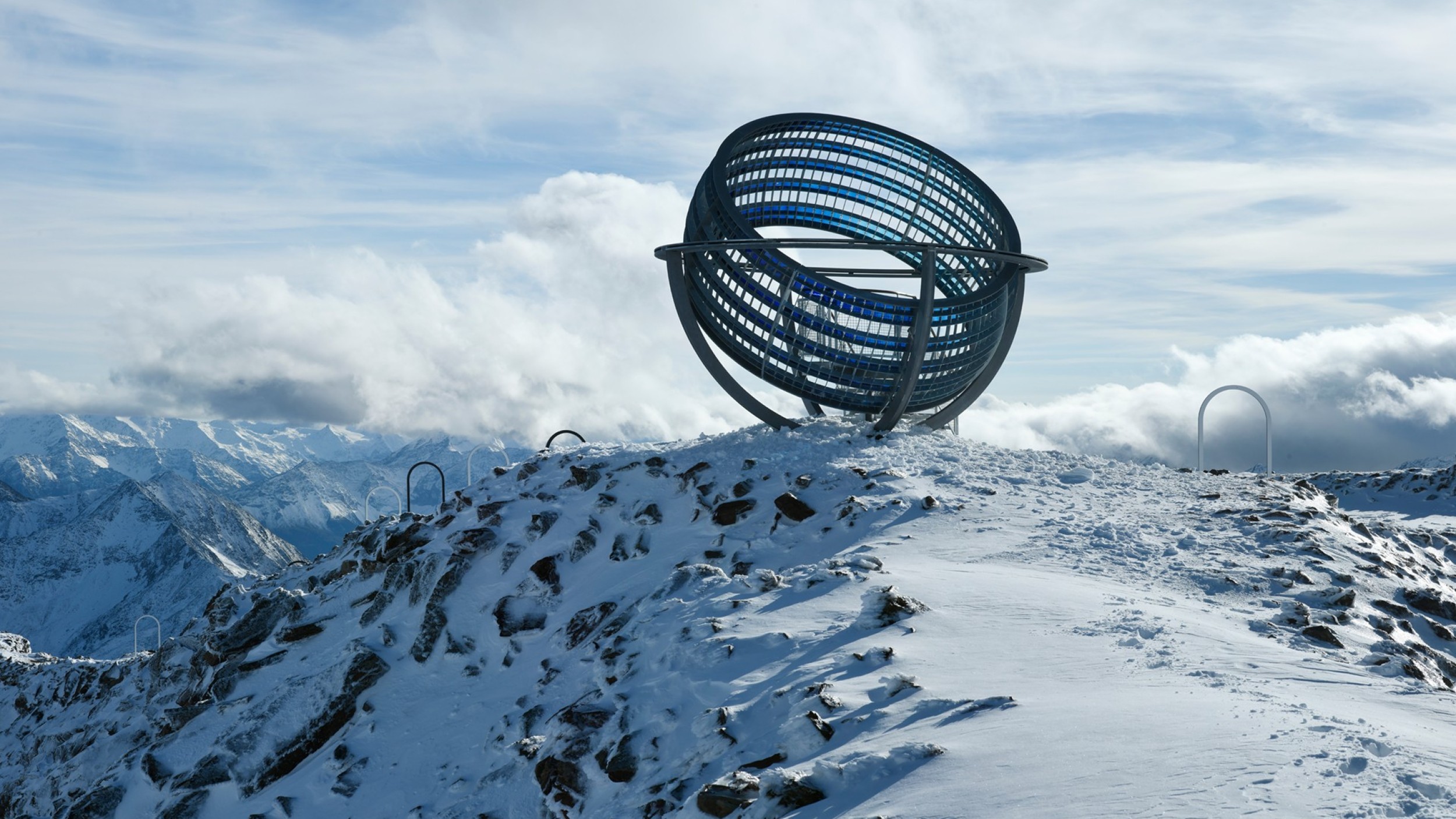
This impressive walkable installation, consisting of steel arches and steel rings with blue glass panels, was commissioned by the Talking Waters Society and created in 2020 at an altitude of 3,212 meters on the ridge northwest of Grawand/Croda di Cornacchio. It is accessible via a short, easy hike from the mountain cable car station and offers unique perspectives of the surrounding alpine landscape and the overarching story of ice in Earth’s history.
New Perspectives
Our Glacial Perspectives
In 2020, on the ridge leading northwest from the Grawand/Croda di Cornacchio mountain station to the Graue Wand/Croda Grigia, an impressive walkable installation was built, composed of steel arches and blue glass panels. At around 3,200 meters above sea level, Our Glacial Perspectives by Danish-Icelandic artist Olafur Eliasson offers a look into Earth's geological history and its ice ages, drawing attention—albeit indirectly—to human-caused climate change.
The work, commissioned by the Talking Waters Society, is easily accessible via a short walk.
Walking Through Ice Ages
Earth has gone through four major ice ages, during which at least one pole was glaciated. The fifth, the Quaternary, began about 2.6 million years ago and continues to this day. Climatic variations over geological time are recorded in today's landscapes, rock formations, and sediment deposits.
In the first part of his installation Our Glacial Perspectives, Olafur Eliasson leads visitors along a ridge at around 3,200 meters above sea level. A 410-meter-long path with nine unequally spaced arches represents the great ice ages. One enters and exits each glacial era symbolically; the distances between arches are proportional to the durations of the ice ages and the warmer interglacial periods between them.
A Broader View
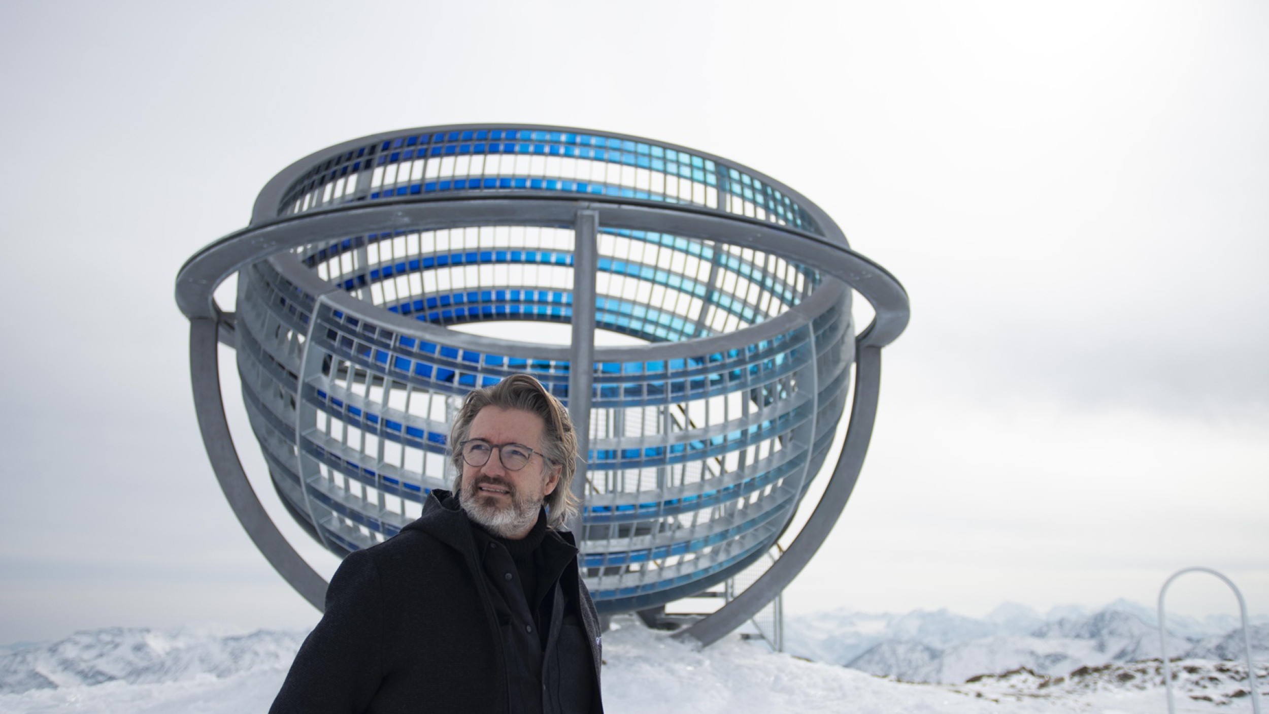
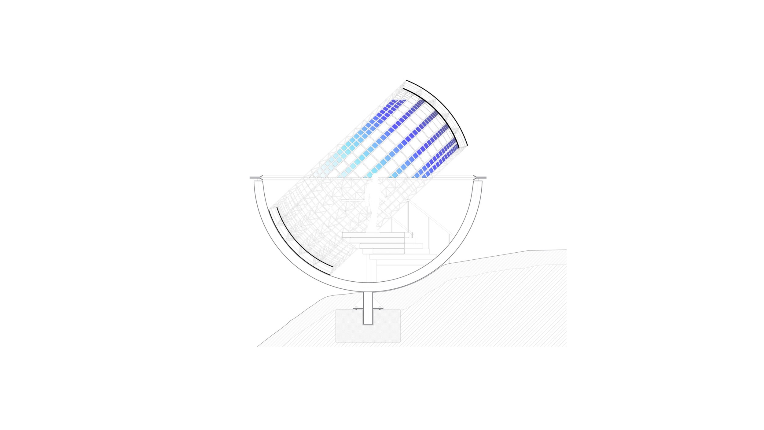
Our Glacial Perspectives leads visitors through the path of the ice ages to a celestial sphere located at the ridge’s highest point. The sphere, 6.8 meters in diameter, is formed of steel rings with glass inserts in various shades of blue. The horizon, cardinal directions, and solar paths allow us to experience the vast dimensions of space and time.
With this work, Olafur Eliasson draws attention to Earth’s development, climate changes, and their effects on our environment—especially on glaciers.
A Journey Through Earth's Ice Ages
2.4 billion years along 410 meters: on the ridge from Grawand/Croda di Cornacchio to the Graue Wand/Croda Grigia, visitors walk through the five major ice ages of our planet. Olafur Eliasson visualizes their durations and the intervals between them with nine arches.
Huronian Ice Age
The Huronian Ice Age, also known (tongue-twister alert!) as the Paleoproterozoic glaciation, began around 2.4 billion years ago. For about 300 million years, the region around the current North Pole was continuously frozen; sea ice repeatedly advanced to low latitudes.
2.4 to 2.1 billion years ago
With a duration of around 300 million years, it was the longest ice age in Earth’s 4.5-billion-year history. It was named after Lake Huron in North America, where sedimentary rocks provide important clues about the glacial movements of that time. A possible cause of this ice age is the decrease in atmospheric methane, a key component of the primordial atmosphere and a highly effective greenhouse gas. The likely cause of the methane drop was the "invention" of photosynthesis by cyanobacteria, which gradually increased oxygen levels in the atmosphere. At the end of the Huronian glaciations, the first eukaryotes appeared—organisms with a true nucleus, including mammals and thus humans.
– Text: Ch. Spötl, Univ. of Innsbruck
Cryogenian
The Cryogenian period began around 720 million years ago and lasted about 90 million years. Strong evidence suggests that Earth was almost completely glaciated twice during this time—known as “Snowball Earth.”
720 to 630 million years ago*
The second-oldest ice age in Earth's history covers a geologically fascinating time, with two near-global glaciations reaching the equator—also known as "Snowball Earth". The breakup of the supercontinent Rodinia, along with intense flood basalt volcanism, is considered a likely trigger for these dramatic climate shifts. It is probably no coincidence that the first multicellular animal organisms appeared at the end of the Cryogenian.
* The beginning of the Cryogenian 850 Ma ago as shown on the path is based on outdated information. A few years ago, this stratigraphic boundary was moved from 720 Ma (see ICS-GeologicalTimescale2020-03), meaning Gate 3 would need to be adjusted accordingly.
– Text: Ch. Spötl, Univ. of Innsbruck
Andean-Saharan Ice Age
The Andean-Saharan Ice Age began about 460 million years ago and lasted “only” 40 million years. Evidence of glaciation has been found in present-day South America and North Africa.
460 to 420 million years ago
This geological period, also known as the Hirnantian glaciation, remains puzzling to scientists. Clear evidence of glaciation is found in West Africa and the Andes, which at that time—long before the Atlantic opened—were located near the South Pole. The emergence of land plants is considered a possible trigger for this global cooling and polar glaciation. Before about 460 million years ago, Earth’s land surface was mostly barren (apart from lichens), but the expansion of plant cover significantly accelerated chemical weathering of rocks, reducing atmospheric carbon dioxide and weakening the greenhouse effect.
– Text: Ch. Spötl, Univ. of Innsbruck
Karoo ice age
This ice age began around 360 million years ago and lasted about 100 million years. The glaciation covered the massive former southern supercontinent Gondwana.
360 to 260 million years ago
Also known as the Permo-Carboniferous ice age, this glaciation occurred near the end of the Paleozoic era and covered a large southern supercontinent known as Gondwana. Gondwana later split into today's continents—Africa, South America, India, Antarctica, and Australia—where traces of this glaciation are still visible (such as in South Africa’s Karoo Desert, hence the name). One likely cause of the global cooling was the preceding Carboniferous period, during which vast amounts of organic material were buried, removing large quantities of carbon from the atmosphere and drastically reducing CO₂ levels—and with it, the greenhouse effect.
– Text: Ch. Spötl, Univ. of Innsbruck
Quaternary Ice Age
Today we live in a warm phase of the most recent ice age—the Quaternary—which began around 2.6 million years ago. The last cold phase maximum was about 25,000 years ago. We are currently in an interglacial period that started about 11,700 years ago.
2.58 million years ago to present
The most recent ice age is the only one in Earth's history that led to glaciation at both poles (the North Pole itself, being in the ocean, cannot become glaciated, but vast areas of North America, northern Siberia, and of course Greenland can). Quaternary glaciations began about 2.6 million years ago in the Arctic, triggering a climatic rollercoaster of long cold phases and shorter warm periods. We’ve been living in one such warm period for the past 11,700 years, following a cold phase that lasted roughly 100,000 years. That glacial maximum peaked around 25,000 years ago, causing glaciers to expand significantly—also here in the Alps—and lowering the sea level by up to 130 meters.
– Text: Ch. Spötl, Univ. of Innsbruck
Die Himmelskugel
Eine Himmelskugel ist eine Hohlkugel, die den Beobachter mit einem gedachten Himmelsgewölbe umgibt. Der Weg durch die Eiszeitalter endet auf 3212 Metern Höhe an der Himmelskugel, dem zentralen Teil der Installation Our Glacial Perspectives von Olafur Eliasson. Sie ist aus Stahlringen geformt, die mit unterschiedlich blauen Glasplättchen besetzt sind. Die Stahlringe sind so positioniert, dass sie als astronomisches Instrument den Verlauf der Sonne am Himmel an den beiden Sonnwendtagen und zu den beiden Tagundnachtgleichen nachzeichnen. Weitere Stahlringe zeichnen die Horizontlinie, die Nord-Süd- und die Ost-West-Achse. An jedem der Ringe sind zudem in symmetrischen Abständen gläserne Rechtecke angebracht, die es erlauben, die momentane Tageszeit zu bestimmen.
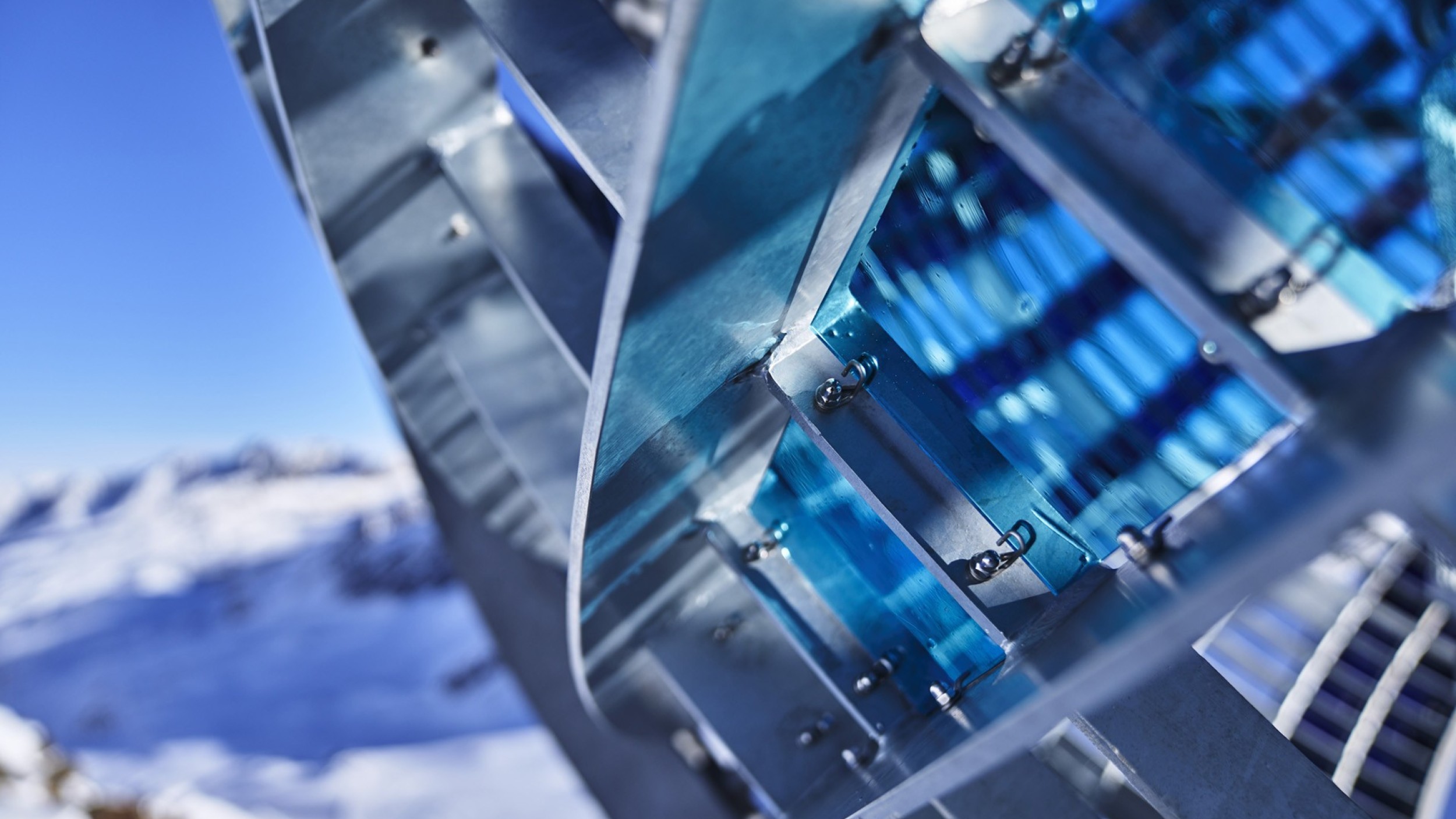
The Blue Tones
The glass plates attached to the steel rings appear in various shades of blue. They are inspired by the cyanometer, a scale developed in the late 18th century to measure the sky’s color intensity. The colored glass filters and reflects sunlight, creating a kind of mini-atmosphere.
The Meaning
Horizon, cardinal directions, solar movement, atmosphere, and the marking of ice ages—all point to the great interconnections of time and space, to the Earth’s development, its climate fluctuations and ice ages, and finally to today’s human-induced climate change and its effects on the alpine environment and retreating glaciers. Even the Hochjochferner/Vedretta del Giogo Alto at the foot of the installation is disintegrating.